
A reputed English daily recently carried an article titled, “The making of an ecological disaster in the Nicobar.” The title is alarming. But nothing could be far from the truth. Let us first peep into the geography of the area in the Andaman and Nicobar Islands.
The Container Transhipment Terminal Project is being built in Galathea Bay, which is at the southernmost tip of India, Indira Point. The point itself is half submerged in sea, post the 2004 tsunami. So is the piece of land leading to the lighthouse at the Indira Point. It may be recalled that the entire tectonic plate had tilted as result of the earthquake which preceded the tsunami.
SIGNIFICANCE OF THE PROJECT
As is evident, this island sits at the mouth of the Malacca Strait which connects the Indian Ocean to the Pacific (through the South China Sea). It is one of the busiest sea lanes through which the world’s energy is transported in the form of crude oil and gas. This being a narrow passage, ships have to slow down and thereby become vulnerable to piracy, theft, unauthorised boarding etc.
As for our adversary, some 40% of their oil and gas is transported through this strait. The energy sources are transported from the Gulf, the Gulf of Aden, the African coast and from South America. The feeling of vulnerability is such that one head of state called it the “Malacca Dilemma” for his country. In spite of their efforts to carry oil through pipelines laid from the discharge port to the refinery by our northern neighbour, significant quantity would have to be through the Malacca Strait.
Given the geopolitical turmoil that the world is witnessing, great power competition is here to stay until a new world order takes shape. When this contest turns into conflict is anyone’s guess. Given that we have long unsettled borders, our strategic advantage remains in the sea, of which the Malacca Strait transit route becomes important. It is pertinent to mention that our adversary already has combat power presence in all the choke points which are used for transit in and out of the Indian Ocean. It is for this reason that the Navy keeps 24×7 surveillance over the entire Indian Ocean and particularly at the choke points. Better preparation will deter any misadventure.
Secondly, significant revenue is being earned by foreign shipping companies by way of transfer of containers from the Singapore transhipment port to Indian destinations. This revenue does not get into the Indian system in spite of containers and users being in India. It is estimated that nearly $230 mn revenue is lost every year by way of transhipment cost to foreign companies in the absence of a container offloading terminal on the Indian side.
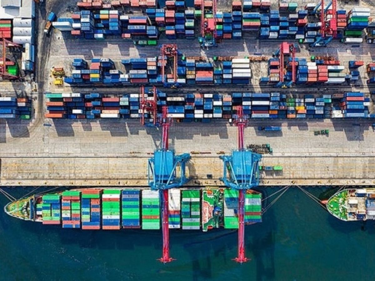
The ICTP also includes development of inland infrastructure which will support the visiting ships for handling large volumes of cargo.
Therefore, we have these strategic and economic reasons to be there. India’s growth as a major power is being watched by the world. It is natural that obstructions would be created to slow this down with the fear of West/East losing their supremacy. Some of these toolkits are playing out in our neighbourhood.
APPREHENSION OF ECOLOGY AND TRIBALS
As far as compliance with extant regulations is concerned—the FRA Act 2006 provided by Ministry of Environment, Forest and Climate—it seems to have been complied with as per local inputs. The interests of the Shompen PVTGs and Jarawa PVTGs represented through Andaman Adim Janjati Vikas Samiti were important part of the sub divisional and district level committees of which tribal officers are an integral part.
To ensure fair representation, the chief of the Tribal Council, Little and Great Nicobar Island (for Nicobari tribal community) and the tribal welfare officer for Shompen tribes were in the sub divisional level committees. Proposal for diversion of land fallings was put up in appropriate committees to consider the holistic development of the Great Nicobar Island. This also included the tribal welfare officer of Campbell Bay and chairman of the council. Only after their consent the project would have moved forward.
It is understood that no rights of Scheduled Tribes, traditional forest dwellers, primitive tribal groups and pre agricultural groups have been violated or infringed upon. This land falling will create much agricultural land for the local residents.
ISSUE OF SHOMPEN DISPLACEMENT
This seems to emanate from a lack of understanding of the geography of this island. The tribes live in Mount Thullier, Laful, Jhau Nala area. The distance between their habitat and Galathea Bay is approximately 30 km in a zigzag fashion across the mountains. Mount Thullier being far away, there is no possibility of uprooting them when the project gets going.
Also, the Shompens are a shy tribe who do not wish any contact with other populations. Probably one or two tribal officers have made contact with them.
As far as Nicobaris are concerned, they are permanent residents and have moved between their original habitats in Car Nicobar, Nancowry and Little Andaman Islands. They have a tribal council and live quite dispersed in northern and western parts closer to a few rivulets.
After India’s 1962 war with China, some claims were made on this island by Indonesia, probably instigated by China. The Indian government then began a resettlement programme in which 69 ex-servicemen’s families were settled in April 1969. Subsequently, larger numbers were settled in various parts of this island. There had been illegal migration from erstwhile East Pakistan prior to the 1971 war. Their main occupation is agriculture.
There is a naval air station in Campbell Bay—INS Baaz. The extension work will ensure operation of aircraft of C-130 Hercules, which can lift troops in a crisis situation. This airfield makes significant contribution to surveillance over the entire area. Considering that it is not beyond imagination for this front to become a hotbed of illegal ingress with offensive intentions, better preparedness is prudent.
There is a mention of 32 to 58 lakh trees being cut, which is far beyond any reasonable local estimate of 10–15 lakh. It should be noted that the Galathea National Park covers nearly 166 square kilometres, which covers 7 revenue villages and comes under the jurisdiction of 3 Gram Panchayats.
Also, the port of Sabang in Indonesia is located just about 170 km (90 nautical miles) away and is being developed jointly by India and Indonesia under their Strategic and Economic Partnership.
CONCLUSION
Any development project is a tightrope walk between benefits and environmental impact. The prevention and likely mitigation are driven by the laws of the land. They must be rigidly followed, which seem to have been followed by all accounts.
In the case of ICTP, it is a tough one, walking between strategic/economic benefits of the country and ecosystem/tribal protection. Here, Nicobaris are largely in the mainstream. It is important to note that the total population of Shompen has been reducing over a period. This is attributed to reducing the number of females and within tribe marriages. In Greater Nicobar Island, the known numbers of Shompen tribe were 229 and that of Nicobaris (Little Nicobar and Great Nicobar) 892. As far as families go, there are 58 Shompens and 235 Nicobaris. Preservation of the tribes has been the top priority of the administration, by all accounts.
With all canons being followed we need to move ahead and mitigate the ill impacts on the way.
Vice Admiral Shekhar Sinha (Retd) is former Chief of Integrated Defence Staff and former Commander in Chief, Western Naval Command.