
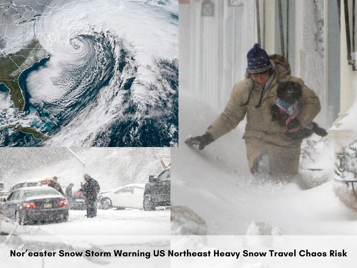
Winter Storm Warning: A powerful nor’easter is expected to sweep across the Northeast this weekend, bringing heavy snow, strong winds, and hazardous travel conditions from Sunday into Tuesday. The National Weather Service issued a winter storm watch Friday warning that more than six inches of snow is likely in many areas, with over a foot possible in higher terrain, as the strengthening coastal storm threatens to disrupt the I-95 corridor from Washington to Boston.
The storm, which could undergo bombogenesis—rapid intensification—just off the Delmarva Peninsula late Sunday, has forecasters watching multiple scenarios that depend on a track shift of just 50 to 100 miles . Snowfall rates may exceed one inch per hour in some areas, pushing totals above six inches along the coast from New Jersey to Massachusetts .
Which Areas are at Highest Risk for Heavy Snow?
The National Weather Service issued winter storm watches at 11:31 a.m. Friday for the Westmoreland Ridges and Fayette Ridges, warning that over six inches is likely during the storm . Higher terrain of West Virginia is bracing for six to 12 inches, with a “Local StormMax” potential of up to 18 inches at elevations above 2,000 feet .
A strong nor’easter is set to deliver snow across much of the Northeast this weekend.
— Breaking911 (@Breaking911) February 20, 2026
A broad zone stretching from eastern Kentucky and Ohio through to New Jersey and southern New England is forecast to receive one to three inches, with localized areas seeing up to six inches . The heaviest amounts will fall on grassy and elevated terrain, while valleys may see lower totals. Snow is most likely to stick to roads and sidewalks Sunday night .
Coastal areas from Virginia to eastern Massachusetts face the additional threat of winds gusting over 40 mph, which could reduce visibility and create dangerous road conditions .
How will the Storm Affect Travel?
Travel turns hazardous Sunday night into Monday with intensifying snow and 40 mph gusts from coastal Virginia to eastern Massachusetts. The combination of heavy snow and strong winds could cause scattered power outages, especially closer to the coast . Icy roads contribute to over 6,000 weather-related traffic deaths and nearly 480,000 injuries each year.
The Monday morning commute is likely to be messy if snow develops as expected . During daylight hours Sunday and Monday, temperatures near freezing may cause snow to melt on contact with treated surfaces, leaving roads merely wet or slushy. However, nightfall changes the equation—heavily falling snow can quickly turn city streets into ice rinks .
This system could also bring coastal flooding due to strong onshore winds, adding to the hazards for coastal communities .
What are the Possible Storm Scenarios?
Forecasters are tracking three distinct possibilities for the weekend storm, each with dramatically different outcomes :
Scenario 1 (40% chance) : The snowiest scenario features a storm that forms and strengthens close enough to the coast to bring heavy snow and wind to the Mid-Atlantic and Northeast. Cities from Virginia Beach to Boston could be hardest hit with widespread travel disruptions .
Scenario 2 (40% chance) : A middle-of-the-road scenario involves a storm that grazes the Mid-Atlantic and Northeast with some snow, bringing a few inches of nuisance-level snow to the corridor—especially close to the coast—from Sunday into Monday .
Scenario 3 (20% chance) : The least-snowy scenario has the storm forming far enough offshore to spare most places from big impacts, producing little to no snow .
A change of just 100 or 200 miles in the storm’s track could be the difference between major cities seeing a full-fledged nor’easter or just light snow that maybe slows travel .
When will the Storm Hit Major Cities?
The timeline for snow appears increasingly likely Sunday night into early Monday, but exact totals remain uncertain . New York City faces a 50% chance of snow Sunday under cloudy skies with a high near 38 degrees, and a 50% chance continues Sunday night .
Philadelphia and New York City could face significant delays and high winds if the storm strengthens rapidly near the coast and tracks farther west . If the storm intensifies later and stays further out to sea—the most likely scenario at present—the I-95 corridor may escape the worst of it .
Cape Cod could see anything from a “pretty significant winter storm” Sunday to a nothingburger with little to no impact, according to Andrew Loconto, a meteorologist with the National Weather Service in Norton .
What About Cities Farther South?
Washington, D.C., Baltimore, Richmond, and Norfolk could also see impacts if the storm tracks closer to the coast . In the snowy scenario, temperatures would be in the upper 20s to low 30s during the storm, meaning snow would be of a wetter, heavier consistency .
Even before the weekend storm, an icy mix is unfolding across the interior Northeast and New England, causing slippery roads and travel disruptions .
FAQs
Q: When does heavy snow start in Northeast?
A: Sunday night into Monday, sticking to roads first.
Q: Which ridges under Winter Storm Watch?
A: Westmoreland and Fayette Ridges, over six inches likely.
Q: What wind speeds hit coastal areas?
A: Gusts over 40 mph from Virginia to Massachusetts.
Q: How much snow in northern Appalachians?
A: Over a foot possible in higher terrain.
Q: Any coastal flooding risk?
A: Yes, from strong onshore winds with the snow.
Disclaimer: This article is based on National Weather Service forecasts and news agency reports as of February 21, 2026. Weather forecasts are subject to change.