
A severe Arctic blast is set to strike the Northeast this weekend, bringing the season’s coldest air, sub-zero wind chills, and widespread snowfall regionwide impacts. The National Weather Service has issued Extreme Cold Warnings and Wind Advisories, urging residents to prepare immediately for dangerous weather lasting through Sunday across the Northeast.
What is the Critical Forecast & Timing?
Dangerous conditions will intensify from late Friday through Sunday morning, peaking on Saturday. A fast-moving clipper system will first deliver 1 to 3 inches of snow along the I-95 corridor, including New York City and parts of New Jersey. The primary hazard follows: a brutal plunge in temperatures accompanied by strong winds. Gusts up to 50-60 mph will drive wind-chill values down to -10°F to -35°F across the Tri-State area, with the most extreme values north and west of the city.
In the wake of a strong cold front, dangerous cold conditions will return to eastern New York & western New England this weekend. Wind chill values (feels-like temperatures) will fall to 20 to 35 degrees below zero, with the lowest values on Saturday Night into Early Sunday. pic.twitter.com/8KfLxAmOsx
— NWS Albany (@NWSAlbany) February 6, 2026
Which Areas Will Be Most Affected?
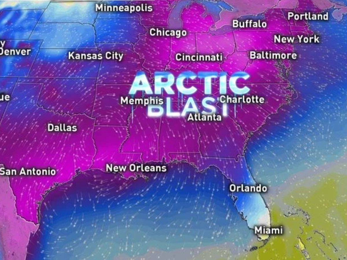
The core of the Arctic blast will center on the Northeast and Mid-Atlantic. New York and New Jersey are under the most severe warnings, with wind chills potentially reaching -35°F in interior and higher-elevation areas. Widespread alerts also cover Pennsylvania, Connecticut, Massachusetts, Maryland, Virginia, and the Carolinas. The cold is so intense that freeze warnings extend into parts of Florida.
What Are the Immediate Safety Actions?
Authorities stress these critical steps:
Frostbite Risk: Exposed skin can freeze in under 30 minutes, and in as little as 5-8 minutes in the worst wind chills. Cover all skin with layers, hats, and mittens.
Home Protection: To prevent burst pipes, allow indoor faucets to drip and open cabinet doors. Never use generators or outdoor heating devices indoors due to carbon monoxide risk.
Travel & Power: Dangerous winter roads are expected. Plan for possible power outages from high winds by charging devices and using battery-powered lights.
Why Is This Cold Snap So Dangerous?
This event combines the season’s coldest air with high winds, creating life-threatening wind chills. The sustained cold also strains infrastructure; recent freezing temperatures already caused water-main breaks in New York and New Jersey. The system threatens power demand peaks and could lead to outages from downed trees and lines.
When Will Relief Arrive?
The most dangerous conditions will persist from Friday night through Sunday morning. A gradual moderation is expected to begin on Monday, February 9, with temperatures rebounding into the teens and 20s across the Northeast.
Disclaimer: This forecast is based on advisories from the National Weather Service and regional meteorological offices.