Heavy rain hits Southern California as flash flood and severe thunderstorm warnings affect Los Angeles County amid powerful atmospheric river.
According to the National Weather Service, coastal and valley areas may receive between 1 and 3 inches of rain, while mountain communities could see 2 to 5 inches by late Monday. (Photo: NYT)
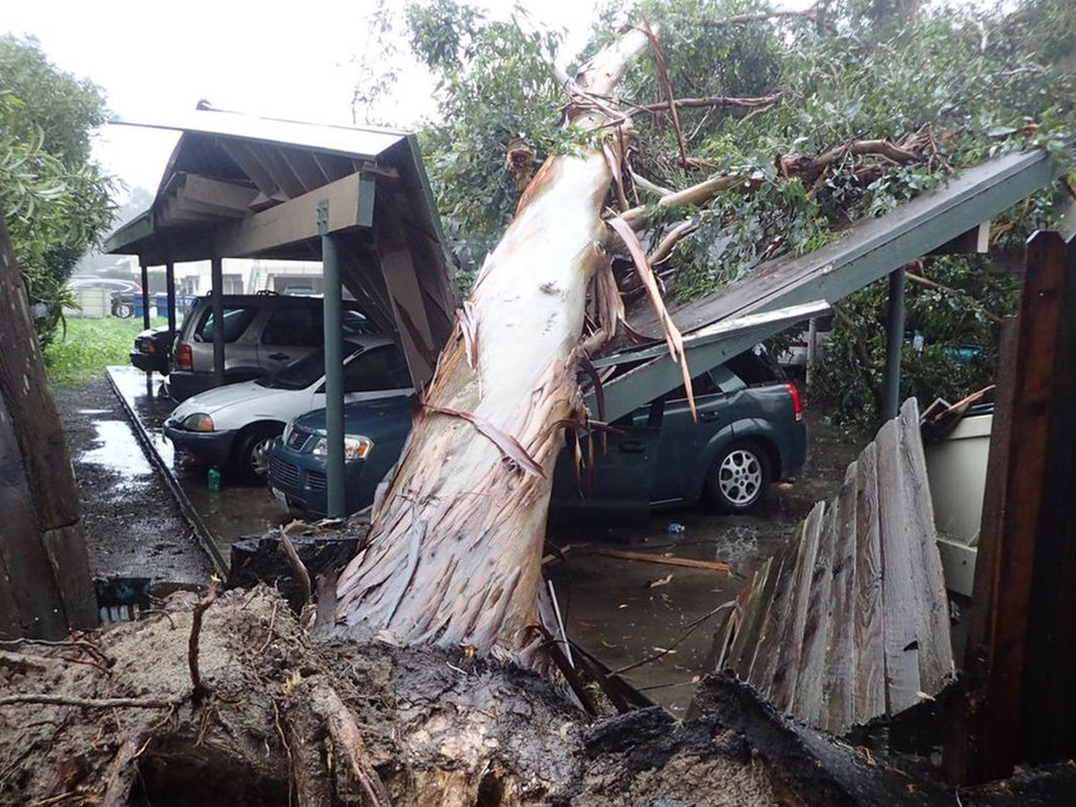
A powerful winter storm system moved across Southern California on Monday morning, drenching cities, flooding streets, and triggering emergency weather alerts. Officials warned residents to prepare for dangerous conditions as heavy rain, strong winds, and mountain snow swept through the region.
Forecasters said this is the first of three storms expected to impact the Southland this week. Meteorologists expect this system to deliver the heaviest rainfall and the coldest temperatures compared to the other incoming systems.
According to the National Weather Service, coastal and valley areas may receive between 1 and 3 inches of rain, while mountain communities could see 2 to 5 inches by late Monday. Higher elevations are also likely to experience significant snowfall.
Authorities issued a Flash Flood Warning for several parts of Los Angeles County, including central Los Angeles, Glendale, Pasadena, and areas near the Santa Monica Mountains. Officials also included burn scar zones such as Palisades and Franklin, where the risk of mudslides and debris flows remains high.
The warning remained in effect until 2 PM Monday. Weather experts cautioned that intense rainfall could overwhelm drainage systems, leading to flooding on streets, highways, and low-lying neighborhoods.
Emergency officials strongly advised residents not to drive through flooded roads. Water levels can rise quickly, and even shallow floodwaters can stall vehicles or sweep them away. Authorities also urged people living near burn scar areas to relocate if necessary due to the possibility of fast-moving debris flows.
In addition to flooding concerns, forecasters issued a Severe Thunderstorm Warning for central Los Angeles areas, including Long Beach and Glendale. The storm system carried the potential for wind gusts reaching up to 70 mph, pea-sized hail, and a low risk of isolated tornadoes.
More than six million people fell under the alert during the peak of the storm. The warning remained valid until 12:15 PM PST on February 16, 2026.
By February 17, officials allowed the severe thunderstorm warning to expire. Authorities reported no major structural damage, but scattered power outages and temporary road closures occurred due to strong winds and falling debris.
Meteorologists linked the storm to a powerful atmospheric river system. An atmospheric river carries large amounts of moisture from the Pacific Ocean and releases it as heavy rain when it reaches land.
Such systems often bring prolonged rainfall, increasing the risk of flash flooding and landslides, especially in areas recently affected by wildfires. Burn scars lack vegetation, which normally helps absorb water and stabilize soil. As a result, heavy rain can quickly turn into dangerous mudflows.
Higher elevations across Southern California are likely to see significant snowfall as colder air moves in behind the storm. Snow accumulation may create hazardous driving conditions in mountain passes and recreational areas.
Officials continue to monitor rainfall totals and river levels. Even though the most severe thunderstorm alerts have expired, meteorologists warn that residual flooding risks remain in some communities.
Authorities encourage residents to stay updated through official weather alerts and avoid unnecessary travel during heavy downpours. With two more storm systems forecast later this week, Southern California remains on alert for additional rainfall and winter weather impacts.