UK issues widespread ice and snow warnings as Arctic air and Storm Goretti set to bring heavy snow, travel disruption, school closures and cold weather alerts.
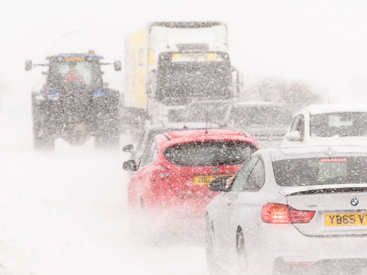
From Thursday evening into Friday, snow warnings expand across large parts of England and Wales, covering major cities as well as rural regions. (Photo: PA)
UK Weather Update: Large parts of the UK are preparing for severe winter conditions as freezing Arctic air combines with the approaching Storm Goretti, raising the risk of heavy snow, icy roads, and widespread disruption. The Met Office has issued multiple yellow warnings for ice, snow, and strong winds, urging people to take extra care over the coming days.
Forecasters say wintry showers are already affecting many areas, with conditions expected to worsen later in the week as the storm moves closer.
Ice warnings are active across much of England, Wales, Scotland, and Northern Ireland, particularly during the early morning hours when untreated surfaces are most dangerous. Northern Scotland faces prolonged snow and ice alerts, with some locations expected to see 5–10cm of fresh snowfall, and higher ground possibly receiving even more.
From Thursday evening into Friday, snow warnings expand across large parts of England and Wales, covering major cities as well as rural regions.
Storm Goretti is expected to play a key role in worsening conditions. As strong winds move in from the south, rain is likely to turn to snow overnight, especially as cold air remains locked in place.
Some areas could see 10–20cm of snow, raising concerns about blocked roads, delayed public transport, and difficult driving conditions. Southwest England may also face strong winds, increasing the risk of travel disruption.
Authorities are warning that travel delays are likely, particularly on untreated roads, pavements, and cycle paths. Drivers are advised to reduce speed, allow extra time for journeys, and ensure vehicles are prepared for winter conditions.
Rail operators have already reported cancellations and disruptions in parts of Scotland, with warnings that services may remain limited until conditions improve. A Met Office forecaster said, “In the ice warnings, be careful of slippery surfaces and potential for injuries, so take care on footpaths.
Icy patches could affect untreated roads, not all roads and pavements and cycle paths are treated, so just be aware that away from major highways, there could be icy and slippery conditions for a while tomorrow morning.”
Heavy snow has forced school closures in parts of northern Scotland, with local councils declaring emergency measures in some areas. Officials have warned that rural communities could be temporarily cut off if snowfall intensifies, and there is also a risk of power disruptions.
Emergency services remain on standby as temperatures continue to fall well below freezing overnight.
The prolonged cold snap has triggered cold weather payments for hundreds of thousands of households, aimed at helping vulnerable families cope with higher heating costs. Payments are issued automatically when temperatures remain at or below zero for seven consecutive days.
Health authorities have also extended amber cold health alerts, warning that low temperatures could affect health and well-being, particularly among the elderly and those with existing medical conditions.
Forecasters say the most disruptive conditions are likely between Thursday night and Friday, with snow gradually easing afterward. However, freezing temperatures could linger, keeping the risk of ice high even after snowfall stops.
Residents are advised to stay updated with official weather warnings and adjust travel and daily plans accordingly.