NEW DELHI: The narratives term our once peaceful homes and fertile land as ‘disputed’ because there’s an entire geopolitical agenda working to steal not only our resources, but also our culture’s inherent meanings, our ideating spirit and our core value systems.
Early this year sitting with a bamboo expert from Karnataka on the lunch table of a start-up summit in Jammu, my mind started thinking about “sarkanda”, a sturdy grass that grows in the river beds in Jammu.
Ironically, to understand sarkanda one has to understand the hydrogeology of this region and since all the rivers and rivulets cross borders to enter Pakistan, the issue no longer remains just about ecology and its flora and fauna, but rather becomes an issue of national security. So let’s understand sarkanda—the grass that’s symbolic of Jammu’s complex borders.
In Jammu they say: Meaning all rivers go to Pakistan. This doesn’t mean that Pakistan is blessed so all our rivers go there. This simply means our borders were drawn cutting through our rivers. There’s nothing rational about it and it never was even in the complex history of kingdoms and wars but it was still not as complex as it’s today.
So let’s understand the geography of these regions where the lower Shivaliks overlap with the plains—in contemporary times this overlap is exactly the region of the borders. What this means is that when rivers come from the hills, they slow down at the plains, their floodplains transform from narrow streams to wider rivers. This slowed waters with expanded width means a different ecosystem that then manifests as different flora and fauna.
Sarkanda, the grass that covered my grandfather’s thatched hut, came from this river ecosystem of the plains. Before the 1950s when there were no roads in the region, the river trails were the commuters’ only routes from hills to the plains—then roads came and the natives forgot about river trails.
However, geography is omnipresent and what the natives forgot, the terrorists revived for their operations. The river trails which were civilizational routes marked with the milestones of ancient temples, then turned into security threats. And the lovely sarkanda, which was a community’s resource turned into a natural hideout for those trying to sneak across the border into Jammu.
MACHEDI ATTACK
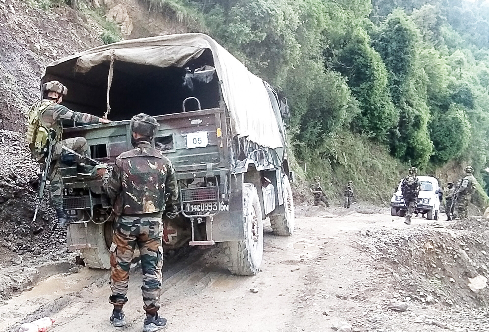
The July 8 Machedi attack has revived my thoughts about sarkanda and river trails and there’s certainly an inter-connection.
Machedi was often a topic of conversation in our living rooms whenever there was a wish for a family holiday in the hills. Even today Dogra Pahadi elders talk about how they hiked to various hilly locations for work in Billawar—Machedi, Banota, Sadrota, Chochru. These names sound different in the local tongue than what their transliteration will give you.
Today the same locations are talked about as “far-off, isolated” spots by journalists rushing from Jammu to cover the situation post the terrorist attack in Machedi on July 8. However sometimes it feels like our connectivity despite increased road and infrastructure has decreased because our knowledge of the geography beyond GPS has minimized. In complex border zones this reality manifests with many challenges.
I’m not saying that the attack in Machedi was carried out by those who sneaked in by hiding in the sarkanda. I don’t have those specific inputs but there’s a high likelihood that they took one of those river trails that starts from the plains (of what’s Pakistan) and crossed the trail at the border in Kathua and followed the river route to Machedi.
How complex is the reality of our borders today
These narratives term our once peaceful homes and fertile land as “disputed” because there’s an entire geopolitical agenda working to steal not only our resources, but also our culture’s inherent meanings, our ideating spirit and our core value systems.
The border not only demeaned our culture and identity, it also demeaned our geography and ecosystems and in over seven decades so much has transpired that there’s likely no going back. And now by killing our people and attacking our soldiers they want to prove that our land is disputed!
Most of us aren’t aware that the British left Pakistan only in 1956—until then Queen Elizabeth II was the Empress of Pakistan and only when it became an Islamic Republic did the British vacate their last military post in Pakistan. In their wake they left behind much death and destruction which they were never held accountable for.
Now since the Machedi incident do you think the locals of the impacted region would be looking for my analysis! Some of their messages tell me they couldn’t sleep the night following the attack and there’s certainly a paranoia around. They are waiting for assurance, for enhanced and permanent security and for a return to normal hikes to their temples and hills.
They will certainly want the borders to remain because someone has decided to infiltrate.

