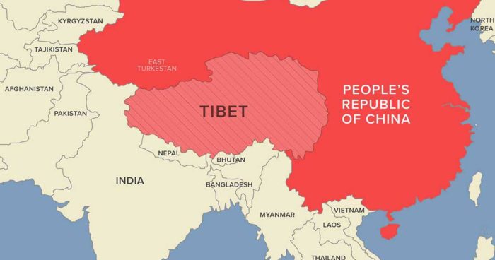
The Tibetan Plateau has in its midst the headwaters and drainage basins of all the ten major river systems of Asia. It also houses thousands of glaciers, thus serving as a ‘water tower’.
John Naisbitt’s quote “Strategic planning is worthless, unless there is first a strategic vision” is an apt way to describe China’s vision of the importance of the Tibetan Plateau.
China has a diverse landscape with the Gobi Desert and the Taklamakan Desert in its north and the Himalaya, Pamir, Tian Shan and the Karakoram Mountain ranges in its west. It has sub-tropical forests in its south and a 14,500-kilometre coastline in its east.
With this kind of a geographical layout, it is but natural that eastern China would be tye country’s centre of gravity. No wonder eastern China is home to about 90% of the Chinese population and has the most important cities like Beijing, Jinan, Shanghai and Shenzen.
Hence, the eastern part of China is the most vulnerable and China is aware that an attack on its coastline would make things difficult as it would get cut off from the world. It is this belly that is the most critical for China.
But to sustain eastern China, water is needed and since all the rivers flowing in China emanate from the Tibetan Plateau, which is located in western China, its criticality assumes immense importance.
The Tibetan Plateau, also known as the Qinghai-Tibet Plateau or the Qing-Zang Plateau, measures approximately 1,000 kilometres north to south and 2,500 kilometres east to west. It is the world’s highest and the largest plateau above sea level and is surrounded by the world’s two highest summits, Mount Everest and K2.
The Tibetan Plateau has in its midst the headwaters and drainage basins of all the ten major river systems of Asia. It also houses thousands of glaciers, thus serving as a “water tower” or a “water tank” to 2.67 billion people living in Afghanistan, Ganga-Brahmaputra basin, southeast Asia and eastern China.
The Tibetan Plateau is also referred to as the “Third Pole” as it holds the largest concentration of ice and glaciers outside the northern and southern poles.
This quite explains that though Tibet declared its independence in 1913, China annexed Tibet after the Battle of Chamdo from October 6-24, 1950 in which 180 Tibetan soldiers and 114 Chinese soldiers were killed. China knows that the control of Tibet is important for its own existence.
China has till date not signed any bilateral treaty regarding the utilization of the water resources with any of the 14 countries that it shares its land borders with, the most important of them being the 1997 UN Convention on the Law of the Non-Navigational Uses of International Waterways.
To make matters worse for one-third of the world’s population that depend on the Tibetan Plateau-origin rivers for their daily chores, China has constructed nearly 22,000 dams over 15 metres in height, since the 1950s. This works out to an average of one dam being constructed every 7.5 days since 1950. No wonder, China has 50% of the worlds over 15 metres constructed dams.
China has effectively changed the basics of life called water to a water weapon and caused irreparable harm to the Tibetan plateau’s ecology and environment by cutting down trees on an unprecedented scale to construct dams and water diversion projects and moving the Tibetan nomads from their traditional grasslands.
Repeated efforts by the countries affected by China weaponizing water have yielded no results as any dialogue and discussion with China on this issue has been stonewalled by Beijing.
John F. Kennedy’s quote, “Anyone who can solve the problems of water will be worthy of two Nobel prizes, one for peace and one for science” is valid even today for the problems that one-third of the world’s population suffers due to the weaponising of water by China.
J.S. Sodhi is a retired Army officer

